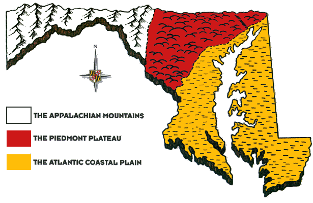
Map of Marylands Regions
From the Atlantic coast on the east to the Appalachian Plateau on the west, Maryland has a great variety of geology and landforms.
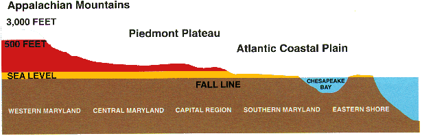
Cross Sections of the State
Maryland's elevation goes from around 3,000 feet to sealevel as you go from the western Maryland mountains to the Atlantic Ocean.
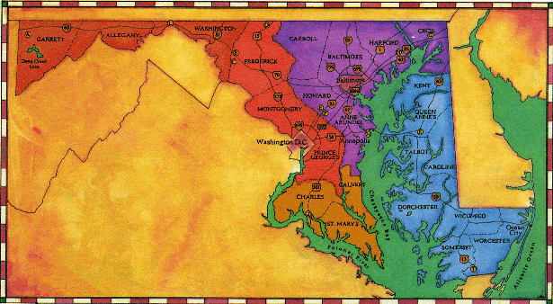
Map of Maryland Counties
There are twenty-three counties in Maryland and Baltimore City. Balitmore City is run pretty much the same way as the other counties. Learn more at the Maryland State Archives.